Needs and Customers in the Field of Airborne System
The field of flying remote sensor systems mostly has two types of users:
Geographic mapping consumers: Geographic maps serve as a basis for decision-making in many life fields, including mapping and construction, land management, management of natural resources, maintenance of natural resources, maintenance of physical infrastructure, geopolitics and more. Consumers in this market are those who operate within these fields, such as engineers and architects, project managers, land owners and managers, state and local government offices, state authorities and others.
Defense industry consumers: Remote sensor systems in their research and development stage which are designated for security and defense have to be flown on a manned aircraft in order to be granted commercial approval for the systems’ quality. Many consumers and clients are required to use an aircraft on a perpetual basis in order to operate their sensor system, but prefer not to invest in acquiring airborne platforms, which concur high expenses and require highly-skilled professional manpower.
LIFEAIR’s Aerial Mapping and Sensor System Airborne Platforms
The main idea behind the building of LIFEAIR’s aircraft fleet was creating a reservoir of flying abilities covering all known mapping heights, from 300-33,000 feet, and system weights of 1-225kgs, inherent electricity capacities of up to 90 amps from the aircraft, as well as flight aids and technologies which provide a stable and professional flight inside the perimeter of airborne systems performance.
When a specialized aircraft is needed for specialized systems, LIfeAir will outsource an aircraft for its clients which will be operated by the company, with its professional know-how.
Piper Cheyenne 3:
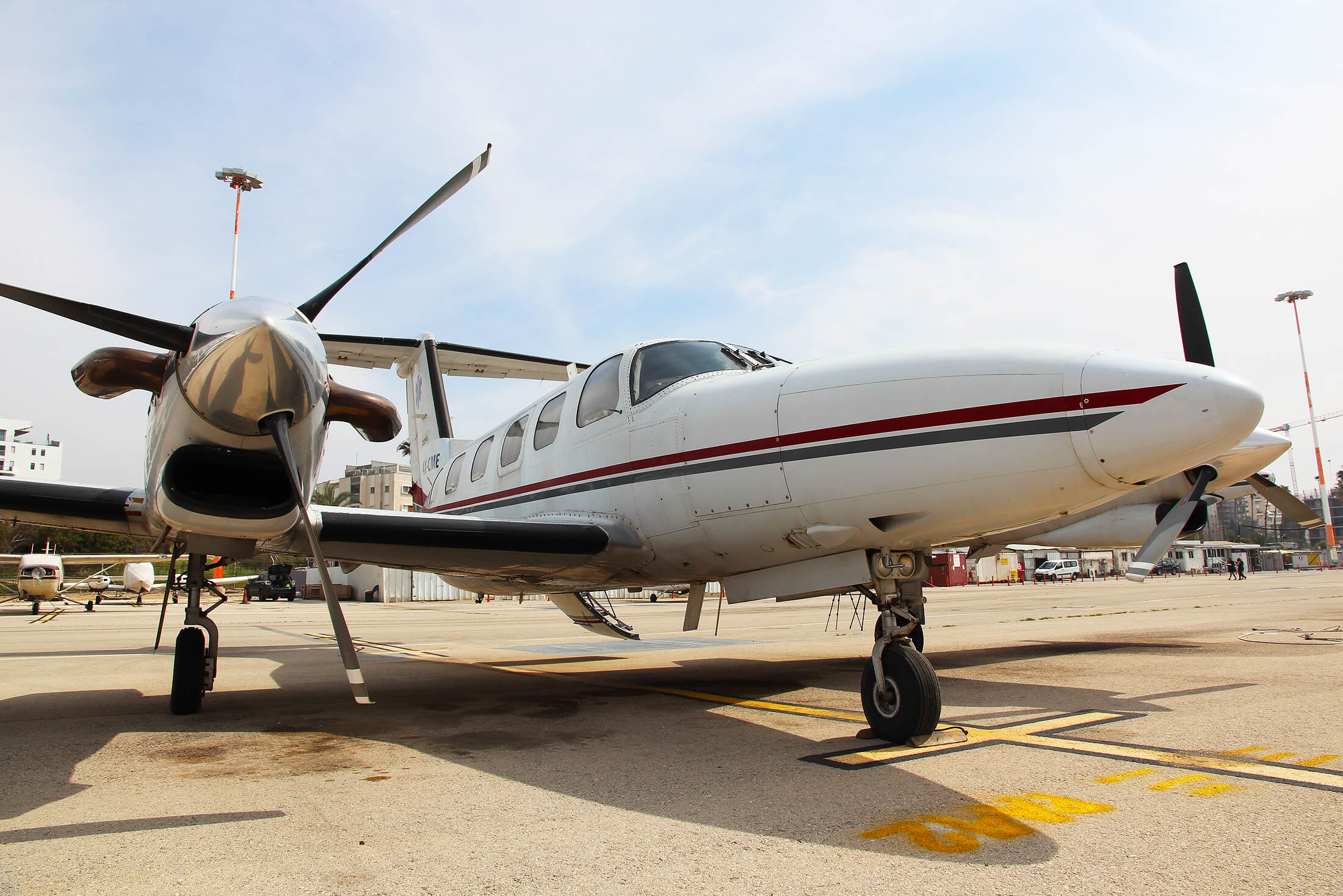
A dual-engine plane with turbo engines which can fly a wide range of heights between 1000-33,000 feet. The aircraft is air-compressed and enables comfortable flying over 13.0 height with no need of oxygen masks. Additionally, the plane has the ability to carry sensor systems on a basis of hard points installed in the front part of the craft’s underbelly. The plane’s speed range enables the flying of systems requiring operation between 120-300 knots.
Piper Aztec 250:
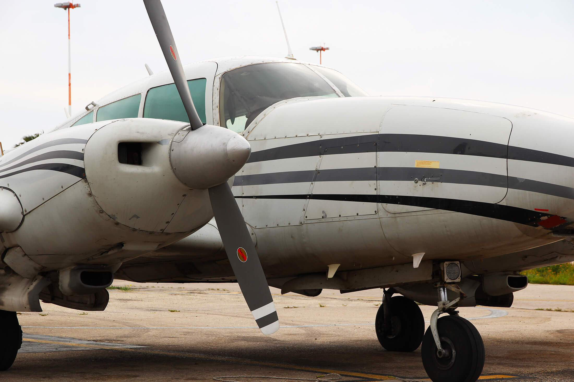
The company owns three dual-piston engine Piper Aztec airplanes which provide the ideal solution for height ranges between 100-15,000 feet. A large photography hatch is installed in the underbelly of all three planes for installing observation and sensor systems. The hatch enables installation of a system in the plane’s cabin with no need of modifications in the plane’s existing faring, which makes the installation easier and more efficient. The hatch can carry systems of various weights. LIFEAIR will coordinate and license the systems for the photography hatch with the help of an adjustment plate for the plane’s floor.
Sizes of Aerial Platforms and Photography Hatches
Sizes of photography hatches and Piper Aztec Plane
Diameter :42 Cm
The hatch fits most airborne sensor systems in the commercial market and those in development.
The plane can stay airborne for up to 6-7 hours, and can carry several air crew members in various flight configurations.
Sizes of Cheyenne 3 Plane and surface area of underbelly carrying area
A client can coordinate a survey of the plane to examine configuration, technical data and general suitability for the desired activity.
Company customers who wish to install systems which observe out of the plane’s photography hatch require various additional services such as land operational accompaniment and coordination of relevant aerial activity.